Surveying and Mapping

GdB specializes in performing boundary surveys, topographic surveys, utility surveys, hydrographic surveys, construction layout, and pre-design base mapping on projects of all sizes. GdB offers innovative solutions and the latest, greatest technology to complete tasks on time and under budget while maintaining fast turnaround and quality deliverables. With extensive experience working with various City, State, and local government agencies, in addition to private utility providers and firms, GdB is expertly capable to exceed expectations on each project. GdB has 12 licensed Land Surveyors on staff. Every project is managed by an LS to ensure accuracy and quality at the highest standard. With a staff of more than 100 professionals, GdB has the largest specialized land surveying staff based in New York.

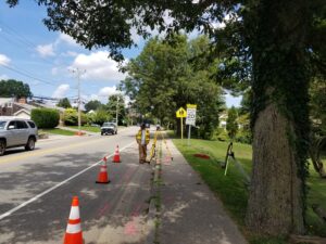
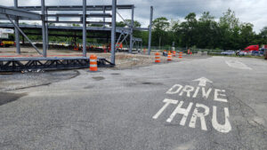
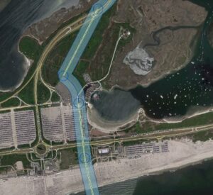
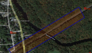
Nassau County DPW – Bay Park STP Ocean Outfall Effluent Diversion

GdB was hired as a subconsultant to provide a variety of Land Surveying services for this large scale effort by Nassau County DPW to divert dry weather effluent from the Bay Park STP to be discharged via the ocean outfall at the Cedar Creek WPCP. This required construction of a new dedicated pump station at Bay Park, a new force main between the two facilities and all related control systems and appurtenances required.

Read More »

PSEG LI – Article VII Malverne to East Garden City

GdB was hired by Burns & McDonnell as a WBE Certified Subconsultant to provide various Land Surveying services on a proposed route for a new 138KV Underground Transmission cable to be used by PSEG to deliver reliable service and grid resiliency to Southwest Nassau County after the failure of two existing 50+ year old cables.

Read More »

NYS Thruway Service Area Redesign

GdB field crews performed detailed topographic and utility surveys for each site, approximately 1.5 to 2 acres in size. All existing structures, pavement edges, sidewalks, curbing, ADA improvements, fences, gates, retaining walls, signage, lighting and visable surface hardware for utilities, and any other planimetric features were located.

Read More »

GW Bridge Rehab of the Trans-Manhattan Expressway Overpass

GdB completed a survey of approximately 3,000 linear feet of roadway along the Trans-Manhattan Expressway Overpass. The topographic and utility survey of the local roads was performed using a combination of stationary LiDAR (High Density Laser Scanning) and traditional robotic total station survey methods. The stationary LiDAR allowed GdB to capture enough detail needed to create surface mapping contours at 0.2 foot intervals. Total Station surveying was used to complete the utility survey as well.

Read More »

HVDC Poseidon Transmission Cable Project

This was GdB’s largest ground control effort for Aerial Imagery to date. Field Crews set aerial targets at specified distances and provided survey accurate coordinates for photogrammetrists to perform their work to accuracy standards. GdB prepared and provided a complete survey file in AutoCAD Civil 3D utilizing pipe networks and progress was constantly tracked in GIS. This huge survey and mapping effort was expedited and completed within only six months, on time and within budget.

Read More »

Amtrak Bridge Replacement over Pawcatuck River

For the site, GdB conducted due dilligence boundary research, obtaining records from publicly available municipal agencies and Amtrak. GdB field crews completed a Quality Level “C” utility survey, compiling record plan data with located surface hardware. This mapping was included in the basemapping deliverables to the client.

Read More »