

Through an existing On-Call agreement to provide GIS Consulting Services between GdB and Westchester County, GdB assisted the GIS team to perform a GIS Needs Assessment across multiple County departments. Westchester County has been collecting various forms of geospatial data from projects performed by County staff as well as contractors and consultants. A Needs Assessment was suggested to the County GIS team as a first step towards organizing and standardizing the Drone and LiDAR data so that the data can be used and leveraged throughout the County. The GdB team was uniquely positioned to complete this task with Westchester County given our Land Surveying, LiDAR/Drone, and GIS technology expertise.
Browsing CategoryLiDAR
FEMA – RISK MAP Region II Watershed Mapping
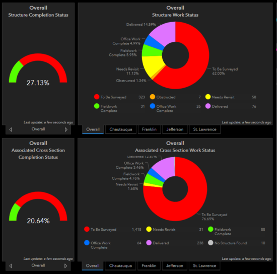
GdB has teamed with STARR II, as a survey subconsultant, through four fiscal years to perform Field Survey to obtain current “on the ground” data to support a RISK MAP Study in FEMA’s Region II which includes, Ontario, Orleans, Tompkins, Yates, Rensselaer, Saratoga, Seneca, Wayne, Chatauqua, Franklin, Genesee, Jefferson, St. Lawrence and Wyoming Counties.
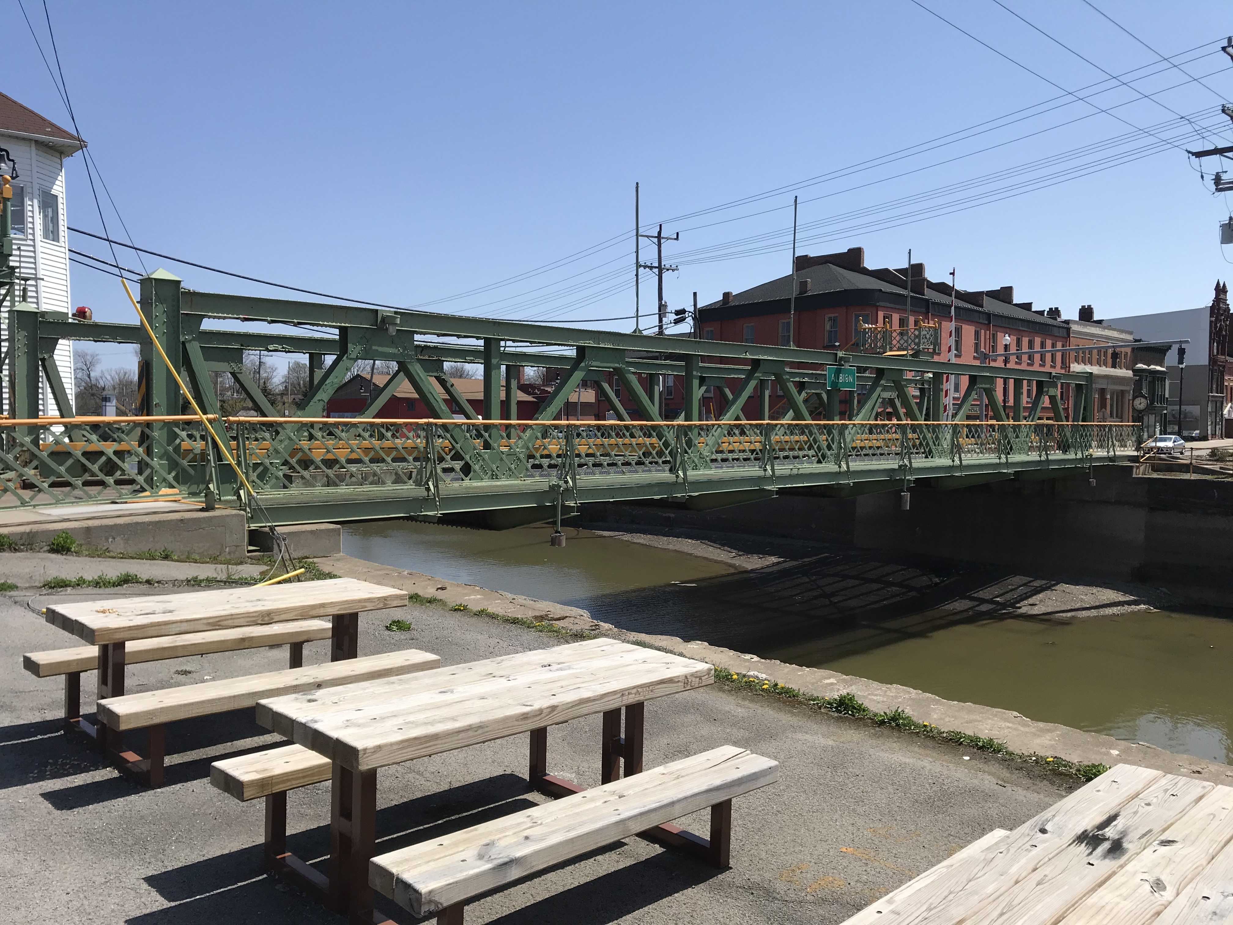
NYSDOT – Erie Canal Lift Bridge Rehabilitation
To assist with a rehabilitation effort on NYS Routes 19 and 98 in the town of Albion and Brockport, GdB Geospatial was hired to complete a laser scan of the existing steel bridges and deliver a point cloud for use in steel manufacturing and fabrication.
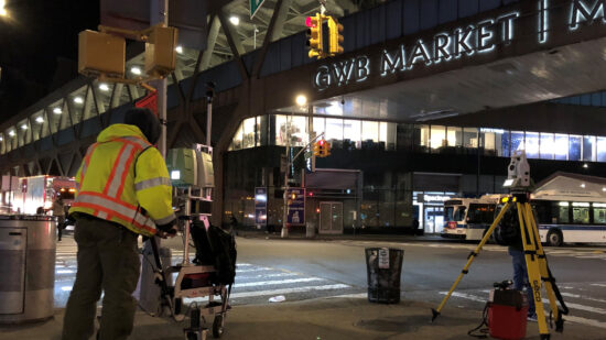
GW Bridge Rehab of the Trans-Manhattan Expressway Overpass
GdB completed a survey of approximately 3,000 linear feet of roadway along the Trans-Manhattan Expressway Overpass. The topographic and utility survey of the local roads was performed using a combination of stationary LiDAR (High Density Laser Scanning) and traditional robotic total station survey methods. The stationary LiDAR allowed GdB to capture enough detail needed to create surface mapping contours at 0.2 foot intervals. Total Station surveying was used to complete the utility survey as well.
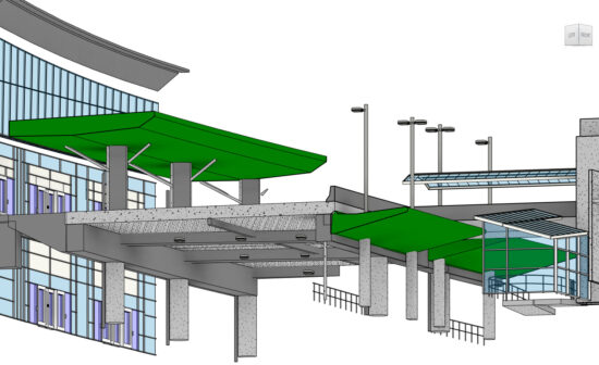
Buffalo Niagara International Airport Revit
For our modeling tasks, GdB also created custom parametric families for items not provided by the manufacture or the client to properly model all features. Based on conversations and specifications from the client, Building Information Modeling for this task was prepared to Level of Development (LOD) greater than 200, but less than LOD 300.